Indonesia’s peat fires spread hazardous haze across South-East Asia
Months of forest and land fires, intensified by a super El Niño and drought, have burned at least 200,000 hectares across Indonesia, with another tracker estimating more than 285,000 hectares so far this year.[1][5] Toxic haze has reached Malaysia and the Philippines, while Indonesia has recorded t…
Months of forest and land fires, intensified by a super El Niño and drought, have burned at least 200,000 hectares across Indonesia, with another tracker estimating more than 285,000 hectares so far this year.[1][5] Toxic haze has reached Malaysia and the Philippines, while Indonesia has recorded tens of thousands of respiratory infections and Malaysia reported a 259 per cent weekly surge in asthma cases in late August.[1] Peatland drainage, forest degradation and deliberate land clearing have made fires harder to control and increased the risk of releasing long-stored carbon.[1][5][6]
Why it matters: The crisis combines an immediate regional health emergency with a climate feedback: dry peat can burn underground, spread persistent smoke and release carbon accumulated over thousands of years.[1][6] With dry conditions expected to peak in September, authorities warn that the toughest period for firefighters may still lie ahead.[1]
Key insights: Pontianak recorded an Air Quality Index above 900, three times the threshold for hazardous air quality, after parts of the region went two months without rain.[1] | Indonesia arrested 72 people in August on suspicion of starting forest fires, while the forestry ministry is investigating burning linked to palm oil plantations and road construction.[1] | The ASEAN Specialised Meteorological Centre activated its highest trans-boundary haze alert for southern South-East Asia.[1] | Greenpeace estimates that about 35 million people in Indonesia are exposed to toxic haze and has urged the government to declare a national disaster.[5]
Cheatsheet facts: What changed: Fires across Sumatra and Kalimantan have burned at least 200,000 hectares and spread unhealthy-to-hazardous haze across national borders.[1][6] | Why now: A strong El Niño has intensified drought, while drained peatlands and degraded forests provide highly flammable fuel.[1][5] | Watch next: Track September rainfall, regional air-quality readings and whether Indonesia declares a national disaster as dry conditions reach their expected peak.[1][5]
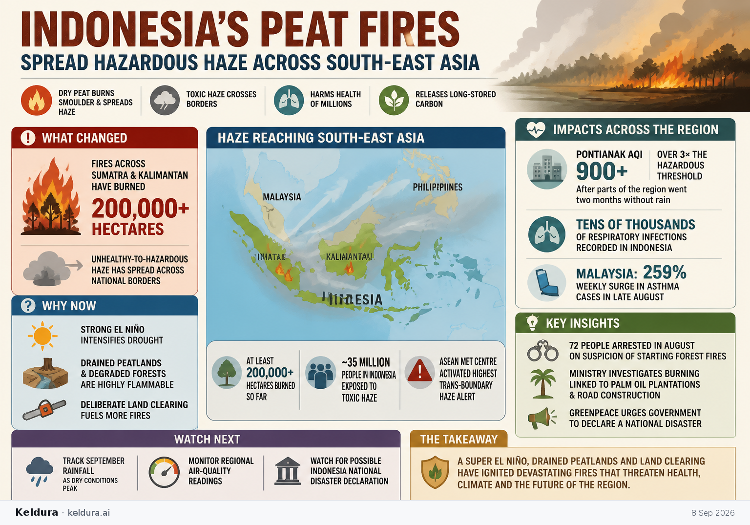
Months of forest and land fires, intensified by a super El Niño and drought, have burned at least 200,000 hectares across Indonesia, with another tracker estimating more than 285,000 hectares so far this year.[1][5] Toxic haze has reached Malaysia and the Philippines, while Indonesia has recorded tens of thousands of respiratory infections and Malaysia reported a 259 per cent weekly surge in asthma cases in late August.[1] Peatland drainage, forest degradation and deliberate land clearing have made fires harder to control and increased the risk of releasing long-stored carbon.[1][5][6]
Why it matters: The crisis combines an immediate regional health emergency with a climate feedback: dry peat can burn underground, spread persistent smoke and release carbon accumulated over thousands of years.[1][6] With dry conditions expected to peak in September, authorities warn that the toughest period for firefighters may still lie ahead.[1]
Key insights: Pontianak recorded an Air Quality Index above 900, three times the threshold for hazardous air quality, after parts of the region went two months without rain.[1] | Indonesia arrested 72 people in August on suspicion of starting forest fires, while the forestry ministry is investigating burning linked to palm oil plantations and road construction.[1] | The ASEAN Specialised Meteorological Centre activated its highest trans-boundary haze alert for southern South-East Asia.[1] | Greenpeace estimates that about 35 million people in Indonesia are exposed to toxic haze and has urged the government to declare a national disaster.[5]
Cheatsheet facts: What changed: Fires across Sumatra and Kalimantan have burned at least 200,000 hectares and spread unhealthy-to-hazardous haze across national borders.[1][6] | Why now: A strong El Niño has intensified drought, while drained peatlands and degraded forests provide highly flammable fuel.[1][5] | Watch next: Track September rainfall, regional air-quality readings and whether Indonesia declares a national disaster as dry conditions reach their expected peak.[1][5]